Map World
Monday, May 27, 2013
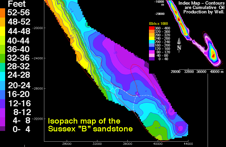
Isopach map (3)
http://pubs.usgs.gov/dds/dds-033/USGS_3D/ssx_txt/all.htm
An Isopach map shows the thickness of certain rocks. This form of mapping is often used by geologist for oil drilling. This particular map shows oil reservoirs in Wyoming.
No comments:
Post a Comment
Newer Post
Older Post
Home
Subscribe to:
Post Comments (Atom)
No comments:
Post a Comment